Call Us Today - 1 (860) 222-3055
Call Us Today - 1 (860) 222-3055
Page 9
Media Contact
Email: media@floodpanel.com
Hope for the Best, Prepare for the Worst
Long before a storm hits, building owners should contact the local emergency management agency to find out if any active flood warning systems are in place. The National Weather Service river-forecast centers prepare river-flood predictions and disseminate them to the public through NWS offices. Note these forecasts do not include many non-residential buildings near smaller streams. Property owners in those areas should work with local and state agencies to develop an adequate forecasting system.
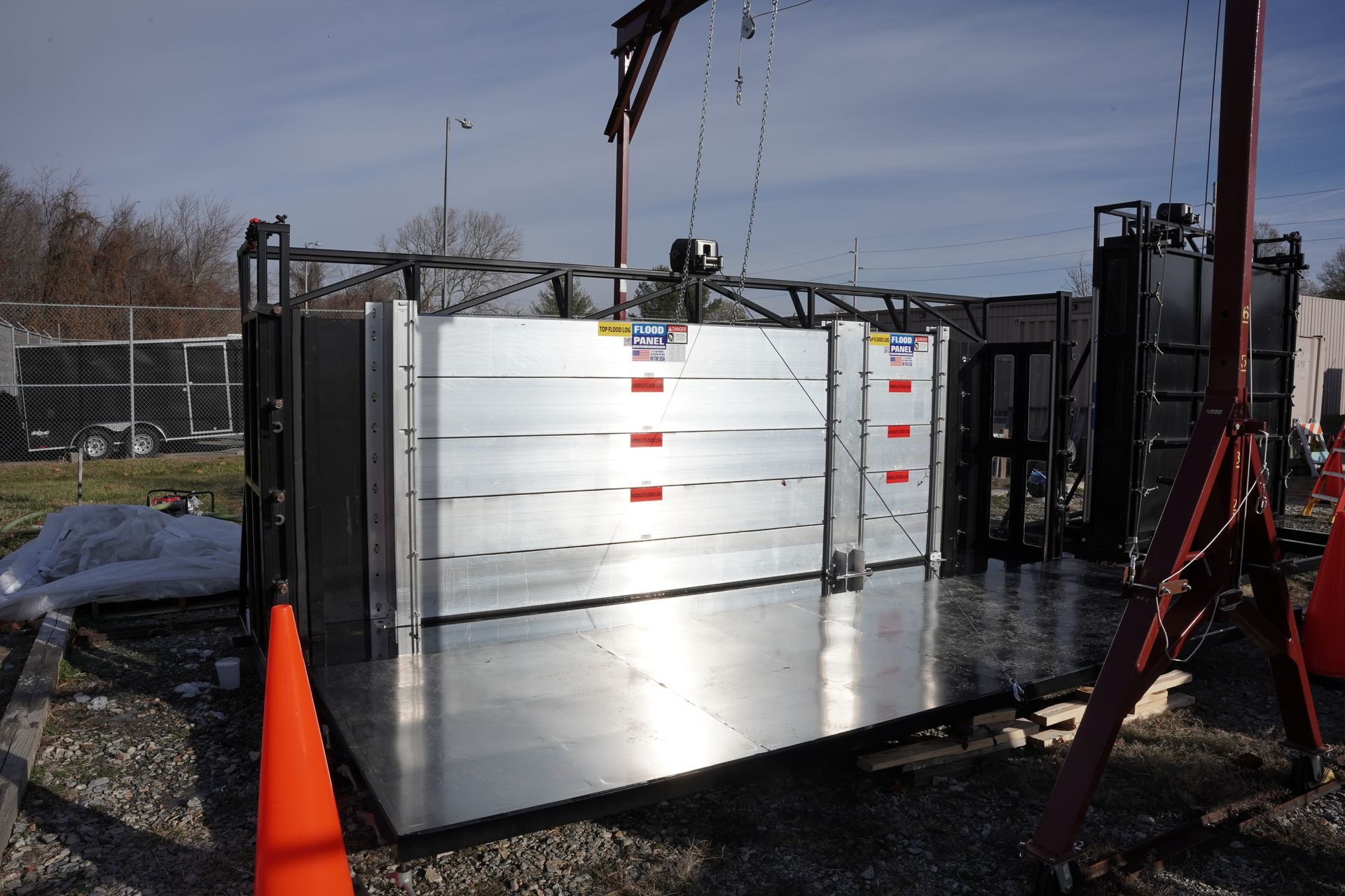
Building owners who have taken steps to mitigate potential flood damage with dry floodproofing systems such as floodgates, floodpanels and flood doors should develop detailed flood emergency operational plans. Plans should include information on how floodproofing measures work during and after a flood event. For example, equipment that requires electricity, such as a sump pump, needs power throughout a flood event.
The plan should establish a chain of command, delineate personnel notification procedures, assign specific duties, describe locations for floodproofing measures, detail install and repair procedures, and include evacuation instructions. It should also include a periodic drill and training program, and a schedule for regular evaluation and updates. Owners should also schedule inspection and maintenance for all flood protected enclosures.
As the 2018 hurricane season approaches, no one knows for sure what impacts this year’s storms will have on the U.S. coasts. For those potentially in harm’s way, it’s best to heed the saying, “Hope for the best, prepare for the worst.”
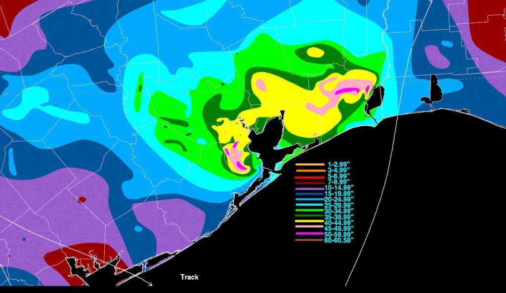
Photo by Eli Christman, Creative Commons License
When one hears the name, “Tangier Island”, pleasant thoughts of tropical vistas with swaying palm trees might come to mind. But in reality, Tangier Island is located off the coast of Virginia, and its primary claim to fame is not balmy beauty but the fact that the island has lost almost 70% of its land mass since the year 1850. Today, Tangier Island is a fast-disappearing symbol of climate change and sea level rise.
According to the most recent census, 727 people make their homes on Tangier Island, which has an area of about one square mile. The island is sandy and sits at a very low-elevation; most of the land is just 3-4′ above sea level. The problem for the inhabitants of this island is that sea level is increasing every year, and at the same time, the land itself is sinking due to the residual effects of an ancient glacier. According to most estimates made by environmental scientists, the entire island will be swallowed by the sea over the next 50 years… if the island keeps losing land at the current rate.
Tangier Island is part of a vulnerable group of islands scattered across the Chesapeake Bay. In the past, these islands numbered well over 500, and were important summer residences for Native American people. The islands even today are rich with oyster beds and crab fisheries, and these resources sustained Native American populations for hundreds of years before the Europeans arrived. Huge piles of ancient oyster shells have been found on the islands, including Tangier, as well as thousands of arrow and spear heads. The weapons are evidence that the islands were once much larger than they are today, and that they supported healthy populations of larger game animals.
Once the Europeans arrived at the Chesapeake Bay, things changed quickly. Native American populations were decimated by disease, encroachment, and the technological advantages of the invaders. A population of British seafarers and fishermen drove off the Native Americans, and settled on Tangier Island. Many habitants living there today are descendants of these hardy seamen, and still bear the old surnames and- because of the extreme isolation of the island- even now present the accented English of their forebears.
However, no amount of pluck and perseverance will be able to save the current residents of Tangier Island. Already today, the island is being swallowed by the sea, and the future looks grim even by the most optimistic of estimates. The land that is still above water is becoming marshy and squishy underfoot, and the sea swallows many meters of coastline every year. People who own homes and businesses on Tangier find themselves looking at a future of homelessness and displacement, with no hope of being able to sell off their assets.
While there is is currently a prospective rescue plan for the island, the plan is projected to cost in the range of $30m- a figure that is completely untenable to save an island important only to the 700 people who live there. And Tangier Island is only one of many endangered inhabited islands on the Chesapeake Bay- why save this particular island and not the others? At the same time, the coastal cities that line the Eastern Seaboard are competing for limited funds to install flood barriers, berms, and other flood control devices in order to stave off inundation. Flooding will be an ever-increasing part of life for all who live near the sea. For those who live surrounded by the sea, flooding will soon claim their entire world.
Source: FloodBarrierUSA
A team of UK-US engineers and scientists have presented their findings, after using cutting-edge technology to study flood patterns in the US. The results of the study, which were detailed at the 2017 American Geophysical Union meeting, appear to show that the current flood hazard maps used by the Federal Emergency Management Agency (FEMA) are woefully out of date and incorrect. The official FEMA flood hazard map is used to determine which properties must carry mandatory flood insurance, based on the officially-assessed risk. If the flood hazard zones are incorrectly identified, many properties may be left at risk of uninsured damage or destruction.
According to the team of researchers, there are approximately 40 million people now living within areas that have a 1% chance of flooding each year. This sounds inconsequential at first perusal, but this level of flood risk is also known as the ‘100-year floodplain’. As we know from recent disasters, the 100-year floods are happening with dreadful regularity in many parts of the US, often in locations that have never flooded before! If a property experiences flooding that was considered by FEMA to be improbable, it is likely that the property was not insured- in which case the owners stand to lose everything without compensation- the funds needed to rebuild. This scenario can destroy lives as well as houses.
As the map above shows, as of April 2017, much of the country has already received updated flood maps in the form of preliminary or effective Flood Insurance Rate Maps (FIRMs). Source: FEMA.gov
Although the new study estimates 40 million people living inside the risk zone, FEMA estimates only 13 million people are living within the 100-year floodplain … a substantially smaller risk pool. This means that as many as 27 million people may be at risk of being underinsured or completely uninsured for flood damage because their property has not been determined by FEMA to be at risk. It may be that many of these people are living with a very false sense of security!
Why do the FEMA numbers differ so drastically from the results presented by the UK-US scientists? This is a question of profound importance to the many millions of people who may be risking disaster, as well as to the engineers and scientists at FEMA who compile the statistics to produce the official flood hazard maps. According to the scientists who were involved with the study, FEMA concentrates too heavily on coastal flooding, and not enough attention is given to floodplains close to rivers, which can be subject to flash flooding during heavy rainfall. The new study was conducted with improved scientific techniques that identified every possible flood zone along US rivers, and here they simulated heavy precipitation events. The results of these simulations are a wake-up call to those who own property in these areas.
So far, the results of this alarming new study have not been utilized by FEMA officials, but the agency is aware of the study and is taking a look at the newly-released data. If the results are embraced and translated into action, many millions of people in the US will find themselves suddenly in need of expensive flood insurance. That would be a hardship, to be sure. But with trillions of dollars worth of assets currently unprotected, an even greater hardship looms as a very real possibility.
Source:: FloodBarrierUSA
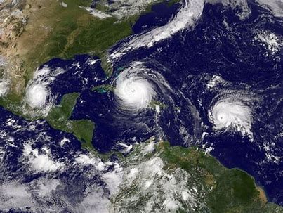
March 2018 roared in like a lion on the East Coast with four nor’easters in just three weeks. These storms brought heavy rain, snow, high winds, coastal flooding and beach erosion to major cities including Baltimore, Philadelphia, New York and Boston.
While hurricanes are notorious for their destructive force, nor’easters deliver the most flooding and damage to the Northeast. Superstorm Sandy, a hurricane, produced the largest storm surge on record for New York City. However, nor’easters caused 88 of the top 100 storm surges in that area, according to a study by Rutgers University-New Brunswick scientists.
In Boston this year, nor’easters hit especially hard with catastrophic flooding that destroyed businesses and homes along the coast. The city recorded a historic flood crest of 15.16 feet during a January storm, and a 14.67 crest in March, the third highest on record for that city.
“There is a tendency to misinterpret the worst effects of a nor’easter. They are usually associated with heavy snow that can shut down major interstates, ground flights and reduce visibility to near nothing. Those effects are certainly crippling, but much of the lasting damage is along the coast, where entire beaches wash away and hundreds — maybe thousands — of homes flood.” (“Major nor’easter will inflict destructive wind and coastal flooding on northeast,” Washington Post, 2/28/2018)
What is a Nor’easter?
According to The Weather Channel, “A nor’easter is an area of low pressure along the East Coast of the United States that typically features winds from the northeast Atlantic Ocean.” In the Northeast, most people think of them as winter storms because of their frequency in that season and tendency to deliver significant snowfall.
The classic nor’easter, referred to by meteorologists as Miller Type-A, forms along the Gulf or East Coast and travels north along the coast. A second type, Miller Type-B, starts in the Midwest, moves east and then reforms along the east coast where it resembles the classic nor’easter. The March storms of 2018 followed the Miller Type-B track.
According to Jeff Masters, a meteorologist and blogger with Weather Underground, nor’easters are fueled by the collision of cold, dry air from the north and moist air from the ocean. Hurricanes have a warm core and need tropical water for energy. In contrast, nor’easters have a cold core and thrive in the colder waters of New England, slowly strengthening along the coast where hurricanes typically die.
Nor’easters vs. Hurricanes
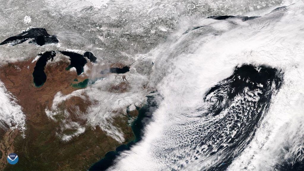
The swirling cloud images of nor’easters and hurricanes taken from space may look alike at first glance, but that is where the similarities end.
Nor’easters are not tropical storms. They generally form between Georgia and New Jersey, while hurricanes typically develop in the tropics, first as thunderstorms off the coast of Africa or as low-pressure systems in the Atlantic.
Nor’easters occur 20-40 times a year in the Northeast. They are more common between October and April, but can form anytime of the year. In comparison, a hurricane makes landfall in the Northeast once every five years. Nor’easters are not only more frequent, but at least two a year are considered severe.
Nor’easters are bigger storms. Typically 3-4 times the size of a hurricane, nor’easters are the largest weather systems in the world and can impact a third or more of the U.S. at one time (“Hurricanes vs. nor’easters. What makes them different?,” Washington Post, 2/13/13). In comparison, a typical hurricane is 300 miles wide.
Nor’easters are slow. They move slower than hurricanes, often impacting one stretch of coastline over several days and tide cycles. A single hurricane may cause more damage than a single nor’easter. However, the frequency and duration of nor’easters can cause billions of dollars in cumulative damages from repetitive coastal flooding, power outages and prolonged wind and waves that erode beaches.
As recent storms have proven, nor’easters pack a punch with the potential for flooding on an epic scale. Residents in coastal communities in the path of these frequent storms should take pre-emptive steps to minimize flood damage from the next nor’easter. It’s not a question of if, but when.
For more information on flood mitigation, visit www.floodpanel.com.