Call Us Today - 1 (860) 222-3055
Call Us Today - 1 (860) 222-3055
Page 17
Media Contact
Email: media@floodpanel.com
Hurricane Matthew, which struck the southeastern US in early October of 2016, was no ordinary weather disaster. Although this storm will probably not go down in history competing with the infamous reputations and death tolls of Katrina or Sandy, its destruction and aftereffects have still not completely abated — several weeks after the storm passed! Matthew may well become infamous in its own right as the storm with the longest-lasting flooding, and over a vast area.
Most people who do not live in the Carolinas have little idea that the destruction is still impacting that zone. They may have read about the storm in the papers, may have seen the incredible rescue videos on TV, but now they assume that the situation has come under control. This is very far from the truth! A full two weeks after Hurricane Matthew passed through, there were some areas that were still experiencing the type of severe flooding that one would expect during the storm, not many days later.
This image shows the amount of rainfall dropped by Hurricane Matthew over the life and track of the storm. IMERG real time data covering the period from Sept. 28 through Oct. 10, 2016 show rainfall from Hurricane Matthew before and after its interaction with a frontal boundary. Matthew caused extreme rainfall in North Carolina resulting in over 20 inches (508 mm) of rain. Credits: NASA/JAXA, Hal Pierce
Here is how this storm came to tear through the Carolinas:
Hurricane Matthew formed off the coast of Africa in late September. It started as a routine tropical storm, but organized itself into a tight knot and gathered strength over the Atlantic until it had intensified into a furious Cat 5 monster of a hurricane, with winds estimated at an incredible 160 mph. Luckily, the storm weakened a bit before slamming into Haiti, where it nevertheless caused hundreds of deaths and a massive humanitarian crisis that will take many years for recovery.
After raking across Haiti, the storm plowed through the northern half of Florida, across Georgia, and then set upon the Carolinas. It is here where many factors collided to produce conditions of hellish and lingering devastation. Firstly, the unimaginable volume of water was mind-boggling: some areas recorded more than a foot of precipitation, which was added to an extremely dangerous storm surge that joined forces with a naturally-occurring high tide — all of which produced a veritable nightmare along the coasts. Fortunately, authorities were able to provide timely warnings of Matthew’s approach, and mandatory evacuation orders saved an untold number of lives. The recommended evacuation zone in South Carolina was for all residents living within a full 100-miles from the coast! In spite of preemptive measures, mandatory evacuations, and early declarations of emergency, 46 people still lost their lives in the US.
After Hurricane Matthew had finished its slow path across the Carolinas, it skirted through part of Virginia and then headed back into the Atlantic. However, the aftereffects of the storm continued to plague storm victims through mid-October and beyond. Millions of residents were left without power, many people who needed emergency services died when help could not arrive, rescues numbered in the thousands, livestock drowned, and countless buildings were swept away. The incredible amount of precipitation from the hurricane storm was augmented by other, lesser storms that moved into the area directly after the hurricane, at a time when the sodden ground was incapable of further absorption. Dams and sea walls that had failed or collapsed during the hurricane released more and more water into the ravaged region. The main interstate highway, I-95, which connects and serves the entire East Coast, was closed with detours of over 100 miles in some areas! In what will clearly illustrate the scope of this disaster, authorities expected that some stretches of this vital highway would remain closed for weeks.
Hurricane Matthew, as devastating as it was, might have been worse in the US if it had struck at its full intensity. Even so, the flooding and water damage will likely cost in the neighborhood of $5.2 billion, and will earn it a place among the worst of the worst.
Source:: FloodBarrierUSA
FEMA has proposed a new rule that details specific actions it will take to implement EO 13690 and the Federal Flood Risk Management Standard (found here). According to an alert sent by the Association of Floodplain Managers to its members:
“The policy would provide specific guidelines to implement the FFRMS for FEMA federally-funded projects, which are actions involving the use of FEMA funds for new construction, substantial improvement, or to address substantial damage to a structure or facility.
The policy would select the use of the FFRMS-Freeboard Value Approach to establish the elevation and FFRMS floodplain for FEMA federally-funded projects that are non-critical actions. For FEMA federally-funded projects that are critical actions, the policy would select the use of the FFRMS-Freeboard Value Approach to establish the minimum FFRMS elevation and floodplain for critical actions.
The policy would allow optional use of the FFRMS-Climate-Informed Science Approach to establish the elevation and FFRMS floodplain for critical actions, but only if the elevation established under the FFRMS-CISA is higher than the elevation established under the FFRMS-Freeboard Value Approach. The policy would also encourage early coordination when multiple federal agencies are jointly engaged in an action to ensure a consistent approach to determine which floodplain determination is applied.”
FEMA is calling on the nation’s floodplain management professionals to provide feedback to help inform FEMA policy makers.
Specifically FEMA is hoping to get feedback on:
1) Its proposed approach to implementation generally, and
2) The impact of the proposed elevation requirement on the accessibility of covered facilities under the Fair Housing Act, Americans with Disabilities Act, Architectural Barriers Act, and Section 504 of the Rehabilitation Act of 1973.
To comment:
1) Go to www.regulations.gov
2) In the search bar, type “FEMA-2015-0006”
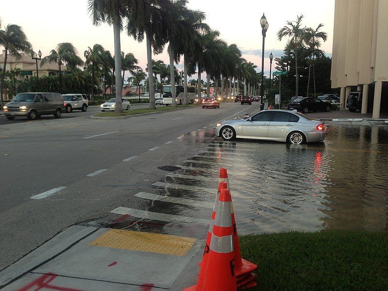
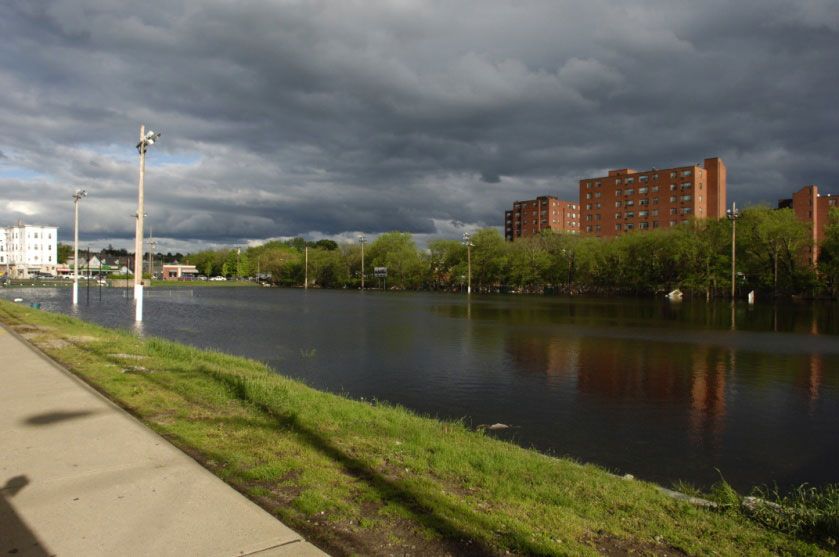
In August of this year, the worst natural disaster since Hurricane Sandy struck, and the state of Louisiana was hit hard. The disaster was brought on by powerful rains that seemingly would not quit, and when it finally did let up, some areas had recorded as much as 31″ of precipitation. Many waterways, including major rivers, hit levels they had never before reached in all the years that records have been kept. Thousands of homes and businesses were underwater, and at least 13 deaths were reported. More than 30,000 people were evacuated, with heroic rescues and narrow escapes throughout the duration of the storm. It was a catastrophe in every sense of the word.
Although the storm that caused this disaster did not have a name, it was right up there alongside Hurricanes Katrina and Sandy in terms of damage and sheer volume of water. The storm dumped about three times as much water in Louisiana as had Hurricane Katrina; up to 6,900,000,000,000 gallons of water! That is enough water to fill the infamous lake Pontchartrain four times. All that water quickly overcame flood defenses, storm drains, and berms, and coursed straight through towns and even major cities like Baton Rouge, with a power that had never been seen before.
Port Vincent, Lousiana, after August 2016 flooding. Source: NOAA
Adding to the devastation of the actual flooding is the devastation of the aftermath. Many of these submerged homes and businesses in Louisiana are located in high-risk areas where flood insurance is either not available at all or completely unaffordable. Another unfortunate situation is that many of the destroyed buildings were located in areas deemed safe from flooding; these properties were not insured because they had been considered out of harm’s way! In one of the worst-hit parishes, fewer than 1% of the property owners had current flood insurance. As a result, many people across that state are cleaning up homes that are simply not salvageable-and since they are uninsured, not replaceable. Tens of thousands of people have lost everything- all their worldly possessions have been simply swept off the map, with no hope of replacement.
As the water receded and people attempted to get on with their lives, there were indications that this disaster will have very long-term repercussions throughout the social fabric of the affected areas. While the number of people in emergency shelters registered in the tens of thousands during the storm, there remain many thousands of people still in shelters more than a full month after the storm. Schools are very far from recovery, due in part to direct damage to the facilities, hardship affecting the school staff members, and a diaspora of students that leaves some schools grossly attended and others over-crowded. With thousands of families living in rural zones that are struggling with muddied and rutted dirt roads, bridges that are washed out or possibly compromised, with a large number of people still clinging to homes that are not habitable- going back to school may not be at the top of the list of family worries.
The storm of August 2016 did not receive nearly the same level of national media coverage as Hurricanes Sandy and Katrina, but from all indications it was just as devastating to property and infrastructure. It will be many years before Louisiana fully recovers from this disaster, and many families will never fully recover at all.
Source:: FloodBarrierUSA