Call Us Today - 1 (860) 222-3055
Call Us Today - 1 (860) 222-3055
Page 21
Media Contact
Email: media@floodpanel.com
As floods become more frequent and much more severe, novel ways of fighting them are cropping up all over the world. In some cases, the “new” flood control techniques may be in fact a return to ancient practices that have been lost in recent times. This may be the case with the recent enthusiasm for the introduction (or re-introduction) of farming practices that can help prevent or reduce flooding in the towns and cities located nearby.
Farmers rely heavily on water for their livelihood. Too much water or too little water — both of these scenarios can spell disaster for those who produce our food supply. Some flood control engineers are advocating for a natural approach to water and soil conservation that will, it is claimed, provide reliable water for the farmers and help protect nearby communities from flooding.
Roller/crimper demonstrated on cover crops. Photo: www.nrcs.usda.gov
The new measures call for several methods of flood control. One idea is to encourage farmers to allow some designated part of their land to be given over to flooding in the event of major precipitation rather than blocking the water — which would in many cases mean directing floods toward population centers. In this case, a farmer might permit some flooding of some cropland in order to protect more developed land. A bonus of this practice is that the flooded land becomes more fertile, having the benefit of alluvial deposits. Of course, in allowing some land to be given over to flooding, the farmer loses the productivity of that land for some time, so most localities are arranging for financial compensation for farmers who participate.
Another method of flood reduction is called conservation tillage. This practice entails simply leaving the fields covered with the stalks, roots, and other debris from last year’s crops. Something as simple as this can make a huge difference in the amount of runoff during storms and can greatly reduce the soil erosion that comes with it. There are many other benefits; including increasing rich organic matter in the soil, improving water and air quality, attracting beneficial earthworm colonies, and even providing sustenance and shelter for wildlife.
But the most important reward of conservation tillage is that it helps to hold water on the land. The stalks of the harvested crops, if left in place, provide shade on the land, preventing much of the evaporation that would occur on completely denuded fields. In addition, the stalks act as tiny dams during heavy rains, slowing the water long enough for it to soak into the ground rather than just running off the land. Wind erosion is also greatly decreased in these fields, and much less dust (and topsoil) flies off with the winds.
While all of these other benefits of conservation tillage may be of great value to farmers, food consumers, and earthworms; when it comes to preventing floods in nearby towns, the most important benefit of conservation tillage is the great reduction of “soil sealing”. Soil sealing is the result of raindrops hitting bare soil, a process that compacts the soil and makes it impermeable to water infiltration. Soil that has been compacted and sealed by hard rains will not easily absorb water, and the water will run off in the same way it runs off asphalt. Fields that are covered with stalks and old root systems will not suffer this compaction, and the water will be slowed down enough to sink into the permeable soil.
As climate change, harmful human activity, and rising sea levels all contribute to an increase in floods and major storms, we will need to change our practices on many levels to reduce the resulting destruction and damage. Conservation tillage is likely to become one of the many useful techniques borrowed from the past that will help ensure a better future.
Source:: FloodBarrierUSA
The status of FEMA’s new Elevation Certificate has raised a lot of questions by communities and users looking for guidance. The Florida Flood Plain Managers Association has shared the following information on FEMA’s new EC.
- FEMA’s official posting concerning the new EC can be accessed here (PDF file will open in a new window). This also includes the new Floodproofing Certificate for Non-Residential Structures.
- There will be no transition or grace period for using the old EC, per federal law.
- If a Land Surveyor, Engineer, or Architect authorized to certify ECs was unable to download the new EC and therefore submits the previous version of the EC, communities should accept the old version, but advise the individual to download the new form for use in all future submittals.
- Please note that this is guidance from FEMA; however, communities can have more stringent requirements and may not allow the old version at all, after a certain date. This policy is up to the community, as long as it meets the FEMA minimum requirements.
- FEMA headquarters deems it an acceptable practice to convert the legal size EC format to letter size as long as all information is included.
- FEMA is currently developing a Word version of the form that will soon be available.

For CRS: For communities using the previous version of the EC during the period of time prior to FEMA placing the new EC on their website with a working link, no “error” will be counted upon CRS visit (Cycle, Modification, or Recertification). Once FEMA or CRS indicate the new EC is available via FEMA’s website, no further use of the older EC will be accepted.
Based on questions and input FFMA has received, and the ongoing EC trainings being conducted by FFMA, the FFMA has developed preliminary suggestions for approaching nuances of the new EC. Please note that these are not official guidance from FEMA.
- Some users of the new EC have been unable to save a completed form using Adobe Reader. Instead, they have needed Adobe Acrobat Pro or a similar PDF editor. This should be resolved once the Word version is issued.
- Note that several sections (i.e., A8/A9.d-engineered openings, B12-CBRS) have replaced the check boxes with “radio buttons.” These can be toggled between the options, but once “checked,” they cannot be “unchecked.” This could require completing the EC again.
- The date formats for B6/B7-Index/FIRM dates are very specific. If manually entered, you should use the MM/DD/YY format for the field to populate to the expanded date format. Any other entries will remain as-is, whether numerical or text only.
- The B9-BFE section inadvertently includes a date drop down menu. Do not use this; instead, type the BFE manually into the field.
- Some users have had difficulty inserting pictures into the “Building Photographs” pages. In this case, add text similar to “The following digital photographs have been attached to this form: front, back, side, openings, etc.” in the picture box. Then insert the photographs into a document editor, such as Word; check the appropriate “Check here if attachments” box; in the appropriate comments section, add text similar to “Photographs attached on separate pages in lieu of the ‘Building Photographs’ pages of the form,” and attach the pages of photographs to the form.
- The page of the form that includes Section G does not have an address header. If this section is completed, the property address from A2 should be repeated at the top of the comments section.
- If you would like to host a training on completing the new EC in Florida, please contact Sally Cook, CFM, FFMA Associate Education Director at sally.cook@mymanatee.org.
If you have any questions regarding this guidance or the form, or input on the new EC, please contact Del Schwalls, P.E., CFM, FFMA Secretary and CRS/Insurance Committee Co-Chair at dschwalls@schwallsconsulting.com.

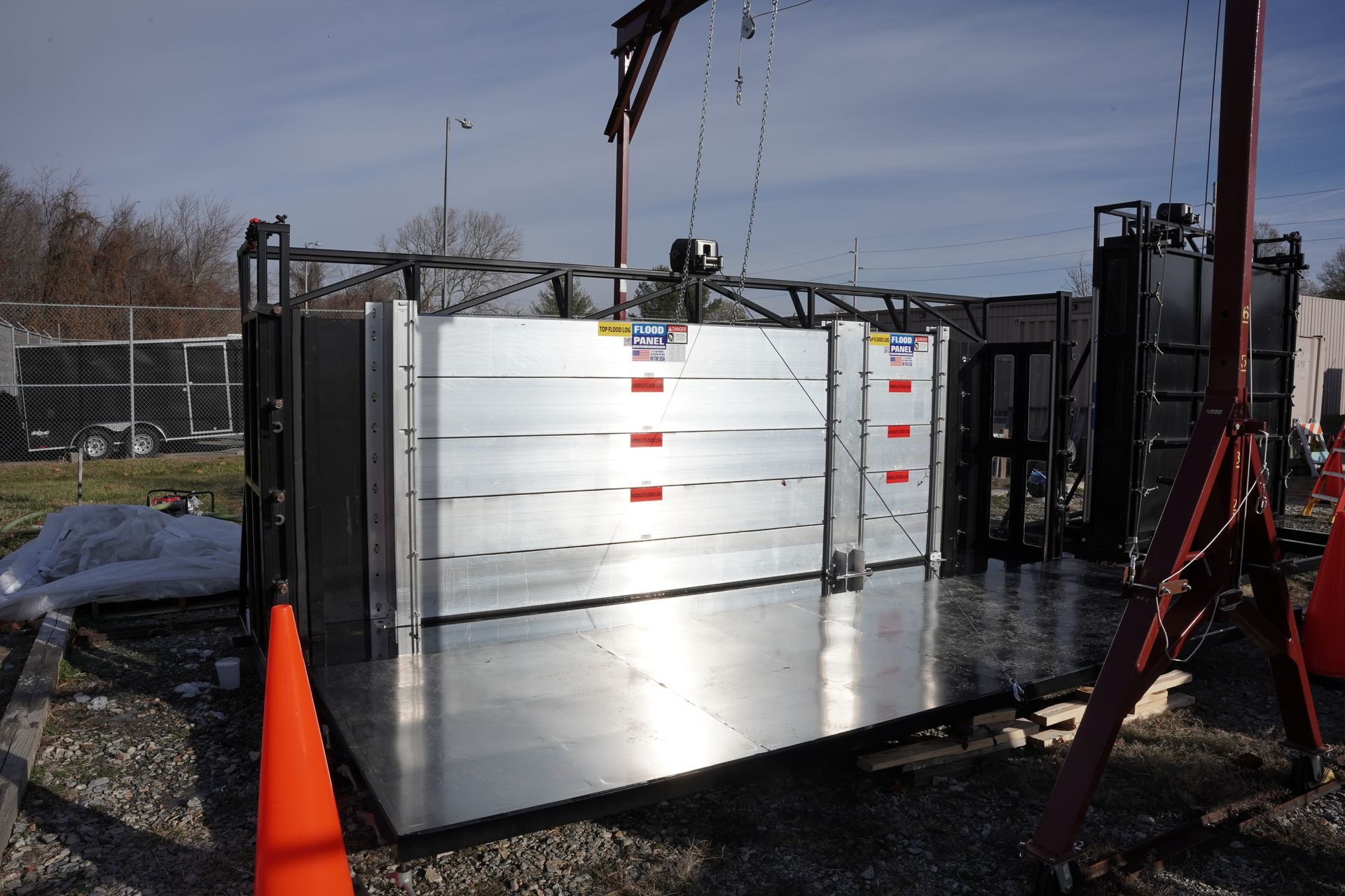
Congratulations to our New England partner F.W. Brown recently featured in this case study by US Builders Review that highlights Flood Panel.