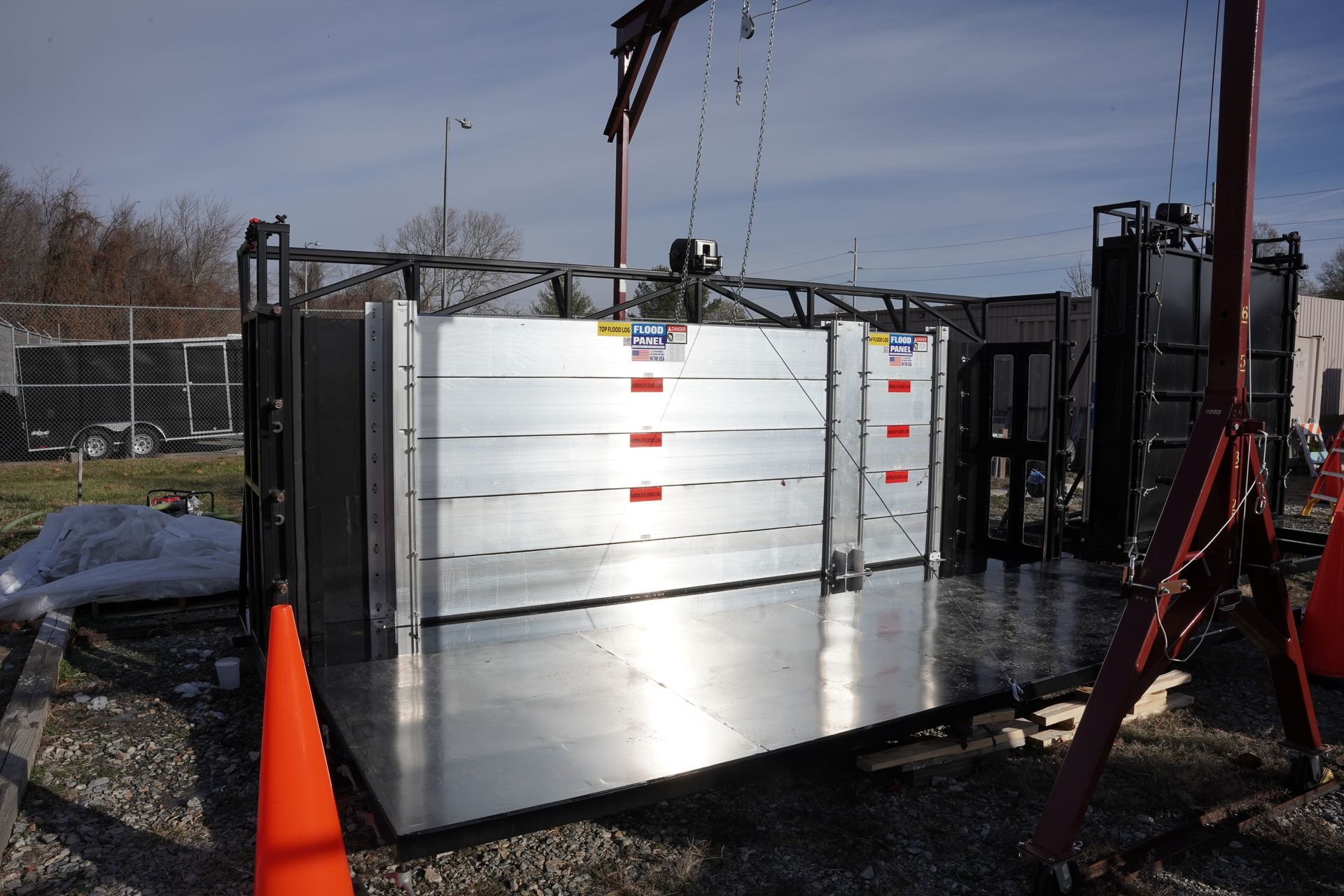
Call Us Today - 1 (860) 222-3055

The flood panel logo is a product of floodproofing.com

Page 22

September 3, 2024

Media Contact

People like to build and live in a floodplain for many reasons. Some may enjoy a pleasing vista that includes a winding river or a seascape. Recreational possibilities abound near water, and waterfront homes are deemed ‘upscale’ and more desirable. In a bygone era, living near the water was necessary for trade, transportation, and even waste removal. However, one aspect of waterfront living has not changed over the years, and may never change: the threat of flooding.

In an effort to lessen the danger from floods, levees have been used in the U.S. since the mid-1800’s. According to the FEMA fact sheet on levees, these early installations were relatively primitive flood barriers that were intended to protect farmland. Whereas the ancient Mesopotamian cultures enjoyed the benefit of allowing their predictable and seasonal floods to enrich the soil, farmers in the U.S. were plagued by capricious floods that came at inconvenient moments. Many of these first levees in the U.S. are still standing, and are still diverting water and averting floods.

In the early part of the 20th century, the U.S. suffered a series of horrific floods that caused many deaths and economic devastation on a massive scale. As a result, Congress passed the Flood Control Act of 1917, which authorized the construction of levees along the Mississippi, Ohio, and Sacramento rivers. Local communities were required to foot the bill for half of the construction costs, and to pay for upkeep after construction. As a result of this legislation, massive building projects were undertaken, relying heavily on the expertise and skills of the U.S. Army Corps of Engineers.

The US Army Corps of Engineers operated the Morganza Floodway for only the second time ever (and the first time for its intended purpose) in 2011 to divert excess Mississippi River water to the Atchafalaya River Basin and relieve pressure on the mainline Mississippi River levees.

Today, many levees run parallel to the rivers they control, and provide an outlet for floodwater to be channeled off and diverted. This has greatly reduced damage and loss of life from floods, but some critics say that the levees have only encouraged more and more people to build their homes inside floodplains. This is dangerous for many reasons, not the least of which is the fact that levees can and do fail. The most recent and spectacular example of levee failure occurred in 2005, when New Orleans was inundated during Hurricane Katrina.

Some environmentalists have also raised concerns over the use of levees. A growing number of critics maintain that levees, while necessary to protect urban areas, should be scaled back or abandoned altogether in rural zones. These farmlands should be allowed to flood, and the farmers should be compensated for their financial losses. This plan is also being widely discussed and considered in the British Isles, which has seen many devastating floods in the last decade. The main objection to the widespread use of levees is that they tend to foster a sense of invulnerability in the community, and that there is a tendency to build and rebuild in these dangerous floodplains because of the perceived protection of the levees. In addition to this fallacious thinking, the levees are an attempt to artificially control wild rivers that may be less dangerous, in the long run, if left to their ancient routes and habits.

Source:: FloodBarrierUSA

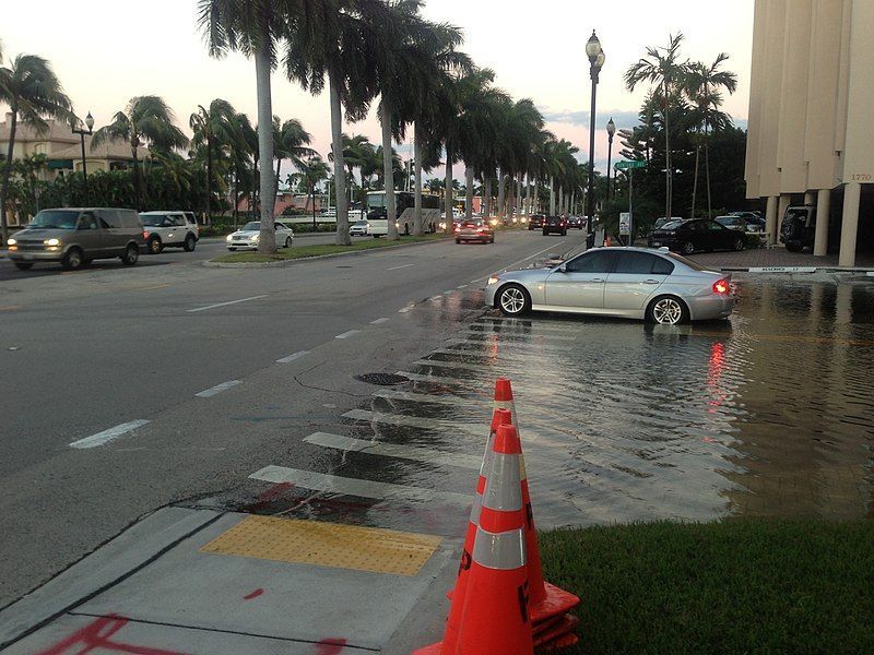
The winter of 2015-2016 has been exceptionally wet throughout much of the continental U.S., thanks to a very strong El Niño weather pattern that has brought both devastation and salvation. The salvation has been experienced in the southwest, particularly the coastal states of California, Oregon, and Washington. These areas have been experiencing an prolonged and vicious drought that has killed countless trees, much native wildlife, and even humans who were killed by uncontrollable wildfires.


This winter, these zones are enjoying heavy and frequent rains that are very welcome — to a point. The problem lies in the rock-hard, parched ground, which does not absorb water. Much of the precious water is running off, into the ocean or into streams and rivers. The mighty Mississippi River and its tributaries are catching a lot of this run-off, and a huge and dangerous flood crest made its way south during the month of January. Unfortunately, the banks of this huge river are lined with many major cities that were founded close to the banks in order to profit from transport and commerce from passing steamships.


Major cities like St. Louis, Memphis, Baton Rouge and New Orleans have all been warily watching the flood crest roll towards them, hoping against hope that levees would hold back the water. Some large towns have suffered flood crests that broke records by over 4.5 feet, in spite of the fact that these records date all the way back to the 1800’s. In addition to major cities and towns, there are many other commercial interests that have been adversely affected by the cresting river. Refineries, docks, warehouses, machinery, and the levees themselves have been threatened by high water.


The U.S. Army Corps of Engineers opened the Bonnet Carre Spillway starting on Sunday, January 10, 2016.


The U.S. Army Corps of Engineers (USACE) has kept a close eye on the flood crest as it moved downstream. This organization has made moves intended to keep the flood under control as much as possible. Spillways were opened strategically to channel the water out of the river in time to prevent flooding in major cities. This move, however, comes with a cost to the communities downstream of the spillways. Hundreds of homes were flooded by the opening of the spillways, in what must seem to those homeowners as a deliberate disaster.


While property damage caused by the opening of the spillways dismayed thousands of people, many, many more people were praying that the opening of the spillways would allow the levees to hold. During the migration of the flood crest, many levees were perilously close to breaching, or even collapse. The USACE announced during the flood alert that 19 levees throughout the Mississippi Valley were ‘highly vulnerable’ to flooding. In the end, many of the levees did fail, and cities from St. Lewis to Baton Rouge experienced widespread flooding. Thousands of people were evacuated from the flood zones, lives were disrupted, property was lost or damaged; but by pure luck no lives were lost.


It is worth noting that although flood records have been kept since the mid 1800’s, all of the worst floods have occurred within the past 25 years. Global warming, rising sea levels, and climate disruption are causing ever more dangerous floods along the Mississippi River as well as the coastal areas of the U.S. It is not just the state of Florida that must worry about preparing for the future, but also the major cities that line the great rivers of the American heartland.


Source:: FloodBarrierUSA

Jonas brings historic flooding to the East Coast

An aerial view of the united states at night

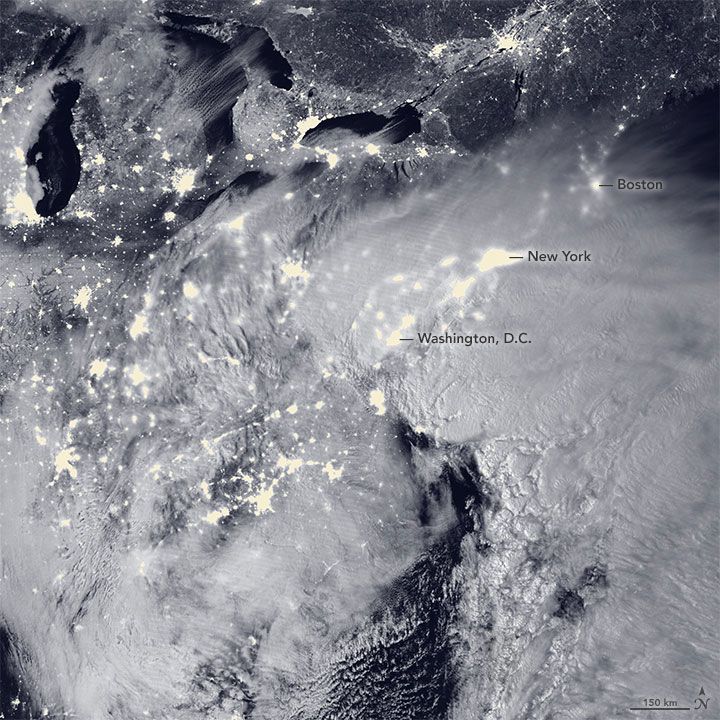
Storm Jonas set more than snowfall records in the Northeast. Much of the coast was also impacted by historic flooding caused by the convergence of a full moon, three high tide cycles and storm surge. For many residents along the coast, the Blizzard of 2016 will be remembered for flooding worse than they experienced from Hurricane Sandy in 2012.


Cape May, N.J. recorded water levels of 8.98 feet during the height of the storm, setting a new record previously set during Hurricane Sandy.


In Lewes, Del., the water level of 9.27 broke its previous record set in 1962.

The cover of a magazine titled the buildings and energy issue.

Resiliency experts: Green Building & Design feature explains why @RISE_NYC chose us for #floodprotection …


Please click here to view article in a new window.

February 13, 2025
Mount Royal, N.J—Engineers, architects and contractors can rest assured that Floodproofing.com has a selection of products that meet and exceed the forthcoming American Society of Civil Engineers/Structural Engineering Institute (ASCE/SEI) 24-24 standards for flood-resistant design and construction. Now the international leader in flood mitigation products has another engineered and tested product that exceeds these new standards for buildings in FEMA flood zones. Floodproofing.com recently conducted third-party testing of its Flood Panel Mega Flood Log System following hydrostatic and impact performance standards of the American National Standard for Flood Mitigation Equipment known as ANSI/FM 2510. According to the new ASCE/SEI 24-24 standards, all flood barriers must be tested and certified to meet the applicable requirements of ANSI/FM 2510. Manufactured at the company’s Jupiter, Florida-based Flood Panel facility, the Mega Flood Log System underwent seepage and impact testing in two configurations 12 feet wide by 5 feet high, and 5 feet wide by 8 feet high. The system was tested in a water tank filled to 10 percent capacity for one hour and 100 percent capacity for 20 hours. The ANSI/FM 2510 test limit for seepage is 0.08 gallons per hour per linear foot of seal – about 10.2 ounces. The Mega Flood Log System tested at 0.01 gallons per hour – about 1.3 ounces, far exceeding the standard. Even after impact testing with a 110 lb. wooden log smashing into the assembled system, Mega Flood Logs showed no additional seepage when retested. “With the more stringent requirements of ASCE/SEI 24-24 about to go into effect, the design and build industry needs assurance that the flood mitigation products and solutions they incorporate are professionally engineered and thoroughly tested,” said Floodproofing.com President and CEO Tom Little, CFM. “We follow a very high standard of excellence for our products, and we are proud of the testing results of the Mega Flood Log System.” Designed to be highly resistant to heavy impact forces and withstand high-velocity water loads typical of flash floods and hurricanes, the Mega Flood Log System is an in-demand flood mitigation solution with hundreds of successful installations and deployments at commercial properties and critical infrastructure facilities. The innovative design makes it easy to install and quick to deploy. The Mega Flood Log System offers the following benefits: Easy Assembly: Offers the lowest reaction times of flood control systems on the market and can be assembled by just one or two people. C-Shaped Support Posts: The system comprises a series of “C” shaped support posts and hollow aluminum beams that anchor the flood barrier system. These beams stack on each other with a tongue and groove connection. The bottom beam of each span is fitted with a large rubber seal that makes contact with the surface achieving a watertight seal. The support posts that attach to the building structure can be installed on a removable basis, minimizing the aesthetic impact on the building. Easy Deployment and Storage: Twelve-inch-high logs cut the deployment time and allow for more efficient, easy storage. Modular System: A modular, stackable system makes it easy to install in specific flood-prone areas, including window openings, across doors and storefronts, as well as an entire perimeter defense against flooding. Because of its modular design, it can run the length of any sized structure. Custom Designs Available: Our team designs custom solutions to fit unique building specifications. About Floodproofing.com Floodproofing.com is the go-to resource for all things related to flood risk and resiliency. We manufacture and supply the largest selection of innovative solutions under one roof and provide complimentary floodproofing design and turnkey assessments that present the best options to mitigate flood damage, improve recovery time, and lower liability risk. In addition, the Floodproofing.com team has spent many years studying the science of flood mitigation and is certified to instruct and provide learning credits to all professionals affiliated with the design-build industry. Also, our in-house insurance agency, Risk Reduction Plus Group, provides NFIP and private flood insurance options with the lowest possible premiums for at-risk communities. For more information, visit Floodproofing.com.
A white car is driving through a flooded street
September 3, 2024
New Floodplain Maps for New Jersey Raise Concerns
Share by: